Kokoda Trail
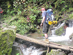
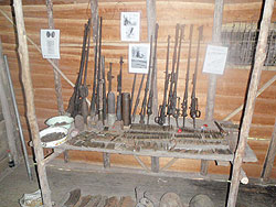
The Kokoda track runs from Owers corner about 50 kilometres from Port Moresby for 96 kilometres over the Owen Stanley ranges to Kokoda village. Hiking the Kokoda track takes you through a variety of environments ranging from low lying swamp to dense rainforest. There is also a lot of history from the second world war as Australian diggers fought to stop the Japanese from invading Australia. The Japanese fought their way from Kokoda village all the way to Imita ridge where the Australians finally stopped the advance. There are still wartime relics to be seen at most of the villages.
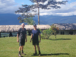
When hiking the Kokoda Track, Papua New Guinea, you can walk the Kokoda Track in either direction, which means either going by bus to Owers Corner from Port Moresby and walking to Kokoda village and then flying back to Port Moresby or alternatively you can fly to Kokoda village and walk back to Owers Corner and then by bus back to Port Moresby.
When I did the walk it was in August 2008 and we flew to Kokoda village and started the walk from there. As you have to fly over the Owen Stanley ranges by light aircraft the weather can and does cause delays. We lost the first day of the hike due to weather preventing us flying to Kokoda village which meant having to make up a day over the period of the walk. If you start walking the Kokoda Track from Owers Corner and walk to Kokoda village then the weather may cause you a delay in flying back to Port Moresby. We had planned to have a short day in the middle of the trip (3 hours) which turned into a long day(11 hours ) to make up the time. It is important to have insurance to cover extra accommodation, missed flights as well as getting evacuated by air in case of injuries.
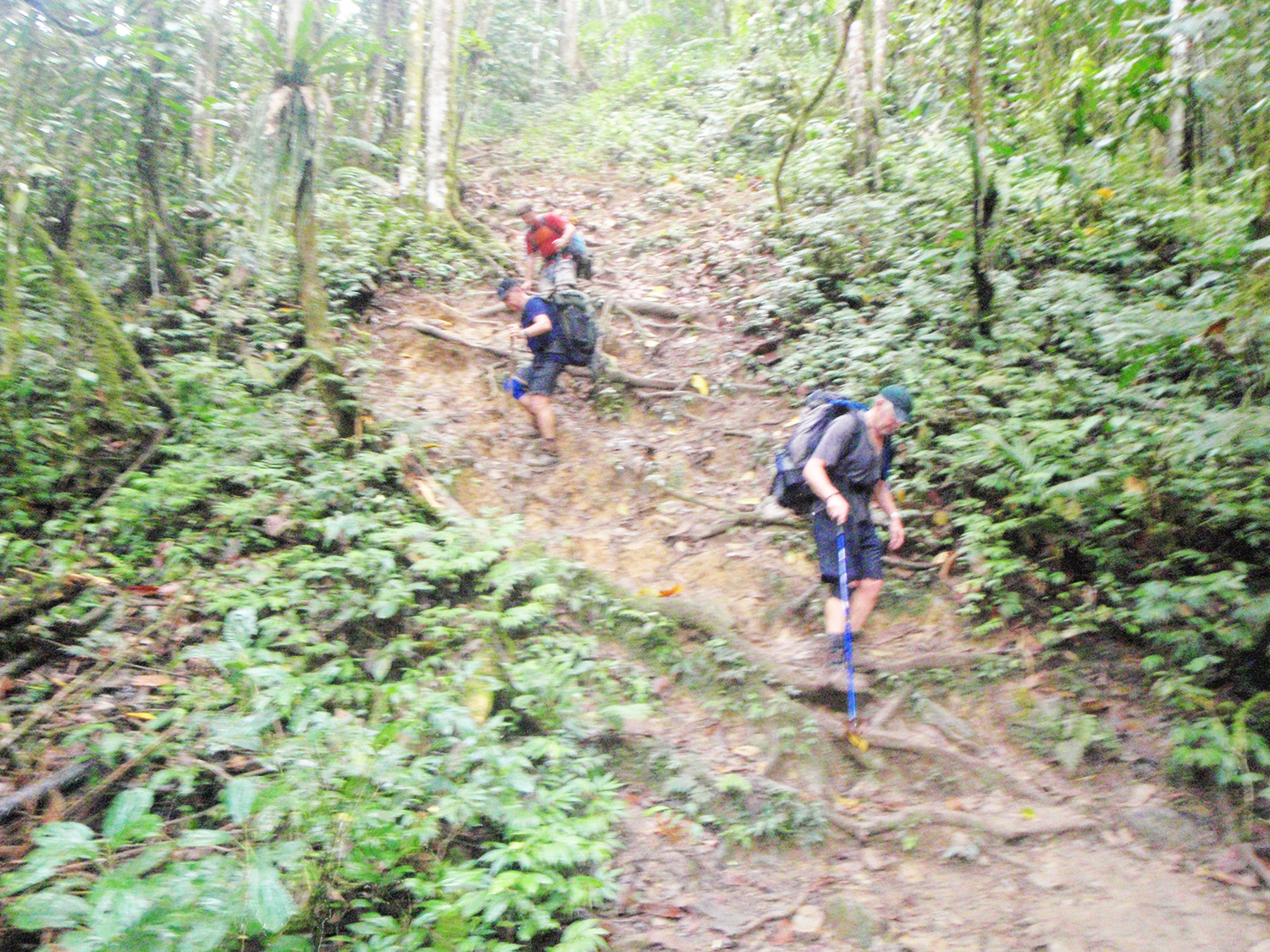
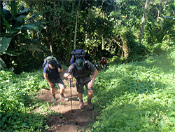
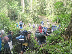
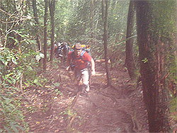
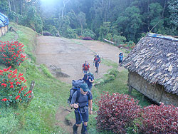
The first day was taken up with a flight to Kokoda village, a look around the museum followed by a three hour walk up to Deniki village. As our guide came on a second flight we didn't actually start walking until about 1pm so we arrived at Deniki at about 4pm. We elected to carry our own packs which weighed in at about 15 kilos. Most people opt to pay local porters to carry their gear which makes the hike less strenuous. We managed to stay in a hut here but most people camped in tents. The walking times can vary immensely as they are dependent on fitness levels, the amount of weight carried, the amount of sightseeing that is done and the track conditions to mention a few.
The next day we hiked from Deniki village to Alola village. It is about 4 hours to Isurava where a large battle took place and there is now a war monument with great views back towards Kokoda village. We had lunch here and then continued on to Alola village which takes 1.5 to 2 hours, where we camped the night.
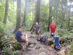
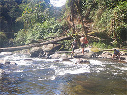
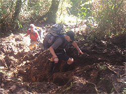
The 3rd day we walked from Alola village to Templeton's crossing this took about 8 hours. There are some steep sections and the day started and finished with down hill sections but was mostly uphill. There is excellent swimming at Templeton's crossing which was most welcome.
Day 4 found us hiking from
Templeton's crossing to Efogi village which was by far the hardest day. There is lot s of climbing and descending and you pass over Mt Bellamy which is the highest point on the track at about 2200 metres. We took a slight detour and missed out on going to Kagi village but this saved a bit of time. Even so this day was about 11 hours and was the day that we used to make up lost time.
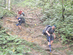
The next day took us from Efogi village to Nauro village which starts of with an uphill section up to Brigade hill which is where some fierce fighting took place in the second world war. There is a monument here and it is a good place to have a rest. There are some steep downhill and uphill sections to walk before arriving at Nauro village. This day was about 9 hours of walking.
Day 6 started at Nauro village and ended up at Ioribaiwa village. It starts out with an uphill walk with 9 false peaks so it is best not to look up as the false peaks give the impression that you are at the top when in fact you have further to climb. This is followed by a steep downhill section and then uphill to Ioribaiwa village This day took about 6 hours.
The 7th day Goes from Ioribaiwa village to the Goldie river and takes about 7 hours. This starts out walking downhill and then goes up to Imita Ridge which is where the Australian forces had decided to stop the Japanese advance at all cost. From Imita Ridge it is a steep downhill section to the Goldie river where we spent the night.

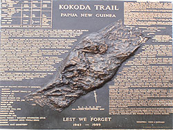
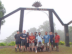
The last day is only a short walk of about an hour uphill to Owers Corner where the walk ends at a war memorial. From here it is a bus ride back to Port Moresby.
The Kokoda track can be walked in eight to ten days and is classified as moderate to hard. Hiking the Kokoda Track, Papua New Guinea is a very satisfying achievement to complete.
The weather on the Kokoda Track in the form of average daily temperatures and rainfall are listed below for planning purposes. These figures are for Port Moresby which is the nearest main town to the Kokoda Track . As Port Moresby is at sea level and the Kokoda Track rises up to 7000 feet these figures are a rough guide only as temperatures can get down to 8 degrees c at the higher altitudes.